
Conroe ZIP Code Coverage
The Texas General Land Office postal-city list identifies eight ZIP codes for Conroe: 77301, 77302, 77303, 77304, 77305, 77306, 77384, and 77385. The labels describe postal coverage, not eight city-limit districts. The coverage rows keep the official local cautions attached to each code, especially where the postal area spreads into surrounding county geography.
| ZIP | Areas Covered | Post Office | Notes |
|---|---|---|---|
| 77301 | Central and eastern Conroe postal area; exact city boundary varies | Conroe Post Office, 809 W Dallas St | Main Conroe ZIP; USPS lookup controls ZIP+4 and carrier route |
| 77302 | Conroe postal area south and east of the central city | Conroe delivery network | Postal city can exceed city limits; verify the situs in GIS |
| 77303 | Northern and eastern Conroe postal area and county-seat region | Conroe delivery network | The Elections office uses 77303; that does not make all of the ZIP incorporated city |
| 77304 | Western and northwestern Conroe postal area, including Lake Conroe vicinity | Conroe delivery network | Use GIS for city, ETJ, and parcel attribution |
| 77305 | Conroe postal listing and PO-box-oriented exception | Conroe postal service | Listed by Texas GLO but omitted from the OIG service-area population report |
| 77306 | Wider rural, eastern, and southeastern Conroe postal area | Conroe delivery network | Postal geography extends beyond the city boundary |
| 77384 | Wider Conroe postal area, including part of the southern regional growth area | Conroe delivery network | Can overlap surrounding communities; GIS determines exact municipal context |
| 77385 | Wider Conroe postal area, including southern regional growth area | Conroe delivery network | City, county, and postal labels can diverge |
A Conroe ZIP code directory is therefore an address-organizing tool. It cannot assign every parcel to a neighborhood, municipal boundary, or household without the corresponding mapping and property records.
Conroe ZIP Service Area
The USPS Conroe Post Office listing identifies the facility at 809 W Dallas St, Conroe, TX 77301-9998, with phone 936-441-6055. A post-office listing is useful for delivery questions and official address verification. It does not turn an entire postal zone into a city-limit zone.
USPS Office of Inspector General material describes seven service ZIPs, 77301, 77302, 77303, 77304, 77306, 77384, and 77385, serving about 178,675 people in 2020. The report describes that service area as 75% urban and 25% rural. Those figures are dated service-area context, not an estimate of Conroe city population and not a ZIP-by-ZIP person count.
The official USPS facility record is the right source for the post-office reference.
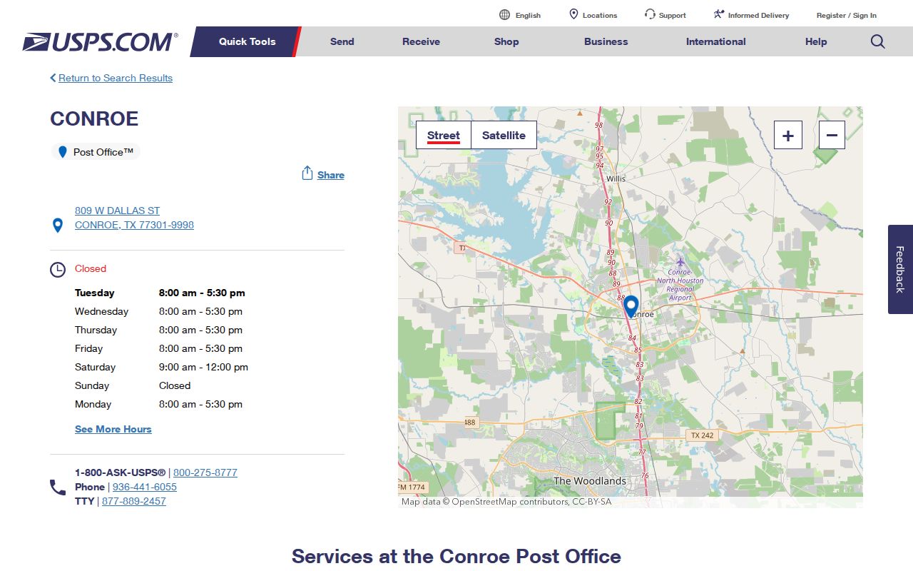
The postal facility information supports address verification while GIS remains necessary for municipal attribution.
Conroe ZIP 77305 Exception
ZIP 77305 deserves a separate note. Texas GLO includes it in the official Conroe postal-city list, while the USPS OIG service-area report names the seven other service ZIPs and omits 77305. The supported conclusion is not that either source is wrong. It is that 77305 is an official Conroe postal listing whose delivery or residential footprint needs direct USPS confirmation.
This local discrepancy makes ZIP copying risky. Treat 77305 as a PO-box-oriented exception in the research record, preserve the source that supplied the label, and verify the specific address product before using it in a parcel or record search. Never infer a general residential service boundary from the omission alone.
USPS ZIP Code basics explains why delivery geography may differ from municipal lines.
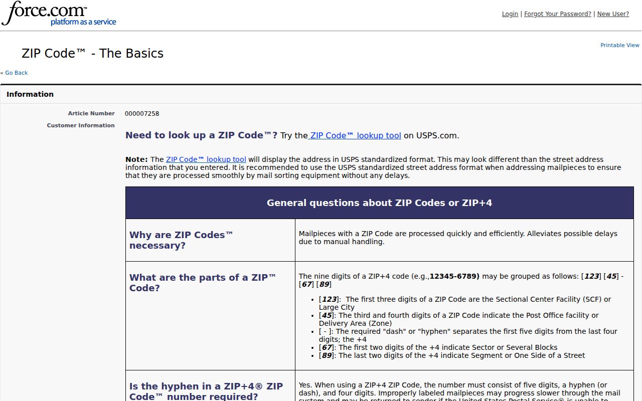
The basic USPS explanation helps keep a postal label separate from a city-boundary finding.
Conroe ZIP Address Fields
A careful Conroe ZIP code search preserves several identifiers at once. The situs or location address identifies the parcel or structure. The owner or party mailing address is where tax or record correspondence goes. A legal description identifies land through a subdivision, lot, block, or metes-and-bounds description. MCAD PropID and GEO ID are appraisal and map keys. The ZIP is the postal routing part of the address line.
Each field serves a different search system. A deed may contain the legal description but omit the modern street line. An owner can receive mail outside Conroe while the situs lies in a Conroe postal area. Store the fields separately so a mismatch becomes a fact to investigate, rather than a reason to overwrite one address with another.
- ZIP code
- A five-digit postal routing label. It does not establish city incorporation or parcel ownership.
- ZIP+4
- An added four digits that USPS can return for a specific delivery point.
- PO-box ZIP
- A postal code used for box service or a specialized postal arrangement, which should not be assumed to map to delivery residences.
- Carrier route
- A delivery-route identifier returned by USPS address data for a particular address.
- Delivery point and check digit
- Address-processing details that USPS data can provide for a validated delivery line.
Conroe ZIP Search Steps
Finding record context within one ZIP begins with a full street address, not a ZIP-wide roster. USPS can validate a delivery line. Montgomery County GIS and CityView can then locate the address point and show its city-limit or ETJ setting. MCAD supplies property and tax context, but the research did not document ZIP behavior as an exportable MCAD search mode. The county voter street form uses ZIP only alongside a house number and street name.
- Use the official USPS address route with the house number and street to confirm the delivery ZIP and ZIP+4.
- Locate the same address in Montgomery County GIS and retain the parcel or address-point context.
- Compare the point with Conroe CityView city-limit and ETJ layers.
- Check the MCAD situs, owner mailing address, PropID, GEO ID, and legal description without treating a mailing field as a location field.
- For a voter-address check, use the county form with house number, street name, and ZIP. The form does not establish a ZIP-wide public export.
Once the postal area is narrowed to a named street, the Conroe street directory has the address-by-address record workflow. ZIP alone is too broad for a reliable person or parcel conclusion.
Conroe ZIP Portal Fields
The Montgomery County Elections street lookup is the local portal where ZIP is a captured narrowing field. Its instructions say to omit directions and street types, and they allow partial street names. The visible research record did not state which fields are required or confirm a public export of every registration in a ZIP. Use the form for a lawful, address-specific check and keep the result within Texas Election Code limits.
| Field | Type and recorded use |
|---|---|
| Street House Number | Text or number field that identifies the address portion of the street search. |
| Street Name | Text field; partial form accepted, with directions and street types omitted as instructed. |
| ZIP Code | Text or number field that narrows the street query. |
| USPS address output | For a specific address, USPS resources can return ZIP, ZIP+4, carrier route, county code, delivery point, and check digit. |
| MCAD search | Owner, address, account, year, and compound-text behavior are documented; ZIP-wide behavior is not. |
The Montgomery County voter street search is the appropriate local source for those street-form fields.
Conroe ZIP City Limits
Postal Conroe and incorporated Conroe overlap without being the same thing. CityView has city-limit, one-foot-strip, ETJ, and surrounding-city layers. The county map adds municipal-boundary layers. Check both when a record is described as being in Conroe, especially in 77384 and 77385, where the broader postal geography can meet The Woodlands, Shenandoah, Oak Ridge-area, and other surrounding places.
The distinction also avoids false conflicts. A county office can use one physical ZIP and another mailing ZIP. The Elections office uses 77303 physically and 77305 by mail, while the County Clerk's main office is on W. Davis in 77301. Those addresses show different postal functions, not separate city boundaries.
Note: Keep postal, city-limit, county, and historical labels side by side when source systems do not agree.
Conroe ZIP Delivery Checks
The USPS address-information reference is the official starting point for delivery-level data. Submit the street address first, preserve the returned ZIP+4 and routing details, then use GIS and MCAD for the parcel record. This sequence reduces errors from punctuation, direction, apartment formatting, or a familiar place name that is outside the incorporated city.
CityView and county GIS are also the practical official addressing references surfaced for 911 points. If an older address will not geocode, retain its original wording, compare its legal description and parcel identifiers, and ask the responsible city or county GIS or addressing office about the current point. Research did not verify a Conroe street-renumbering project or year, so none should be assumed.
USPS provides the postal source; parcel and municipal questions belong to the corresponding local custodians.
The address-validation resource belongs at the front of a delivery check, before mapping the verified address through local systems.
Conroe ZIP Geography
One final comparison keeps the records straight: a 1938 Sanborn map provides historic downtown building and street context, a current MCAD parcel provides tax context, and a ZIP provides delivery context. They are useful together because they answer different questions. They should never be merged into a single claim about the current city boundary or a present-day address.
Conroe's rapid growth makes that distinction more important. A current street label may be newer than an older deed, directory, or map. Use the exact address, PropID, GEO ID, legal description, postal code, and map layer that each custodian supplies. The result is a clear record trail rather than a ZIP label asked to carry more than it can show.
The USPS reference source is shown below as a reminder that postal verification is only one layer of local address research.
After postal validation, local GIS and parcel records supply the separate boundary and land context.